![]()
LATEST STORIES:
![]()
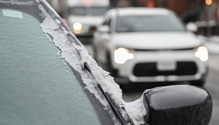
A messy mix of snow and freezing rain is set to hammer parts of Ontario.
Local power outages, slippery commutes and reduced visibility are possible on Wednesday when a low-pressure system developing over Montana moves eastward and descends on Ontario, Environment Canada said.
It will be a “very mixed bag” of precipitation in the Greater Toronto Area, said warning preparedness meteorologist Eric Tomlinson. There, the storm will likely start as rain before switching to freezing rain and finishing as snow. About two to four millimetres of ice buildup is possible along with about five centimetres of snow.
Into cottage country and east of Highway 400 toward Kingston, precipitation is expected to fall mostly as ice pellets and snow, with local snowfall totals of 10 to 15 centimetres.
“It’s going to be a messy winter weather system for southern Ontario,” said Tomlinson.
The system is expected to move into Thunder Bay on Tuesday night and linger through Wednesday, dumping about 10 to 20 centimetres of snow.
To the south, one of the hardest hit areas is shaping up to be a stretch from Waterloo through to Lake Huron. Strong winds are expected to combine with ice buildup of up to 15 millimetres, raising the risk of downed trees and power outages.
Tomlinson said the recent stretch of mild temperatures could help to limit that ice buildup, especially at the outset of the storm.
Windsor and other areas around Lake Erie could see between 15 and 25 millimetres of rain on Wednesday, he said.
The incoming wet weather combined with melting snow, including the remnants of last month’s major storm, has also raised the flood risk in parts of southwestern Ontario. Several conservation authorities have issued early notices of potential flooding, what’s called a flood outlook.
A February melt last year in Ontario and Quebec coupled with rainfall contributed to an estimated $160 million in insured damages, the Insurance Bureau of Canada said, citing flooded basements and collapsed roofs.
Another round of winter precipitation is expected to hit Ontario again before the weekend, Tomlinson said. While the storm track was still a bit uncertain, he said the brunt was likely to be felt on Friday in southwestern Ontario.
This report by The Canadian Press was first published Feb. 17, 2026.